
a warm, breezy end of meteorological winter
The last day of meteorological winter will be warm and breezy, with meteorological spring looking more active.
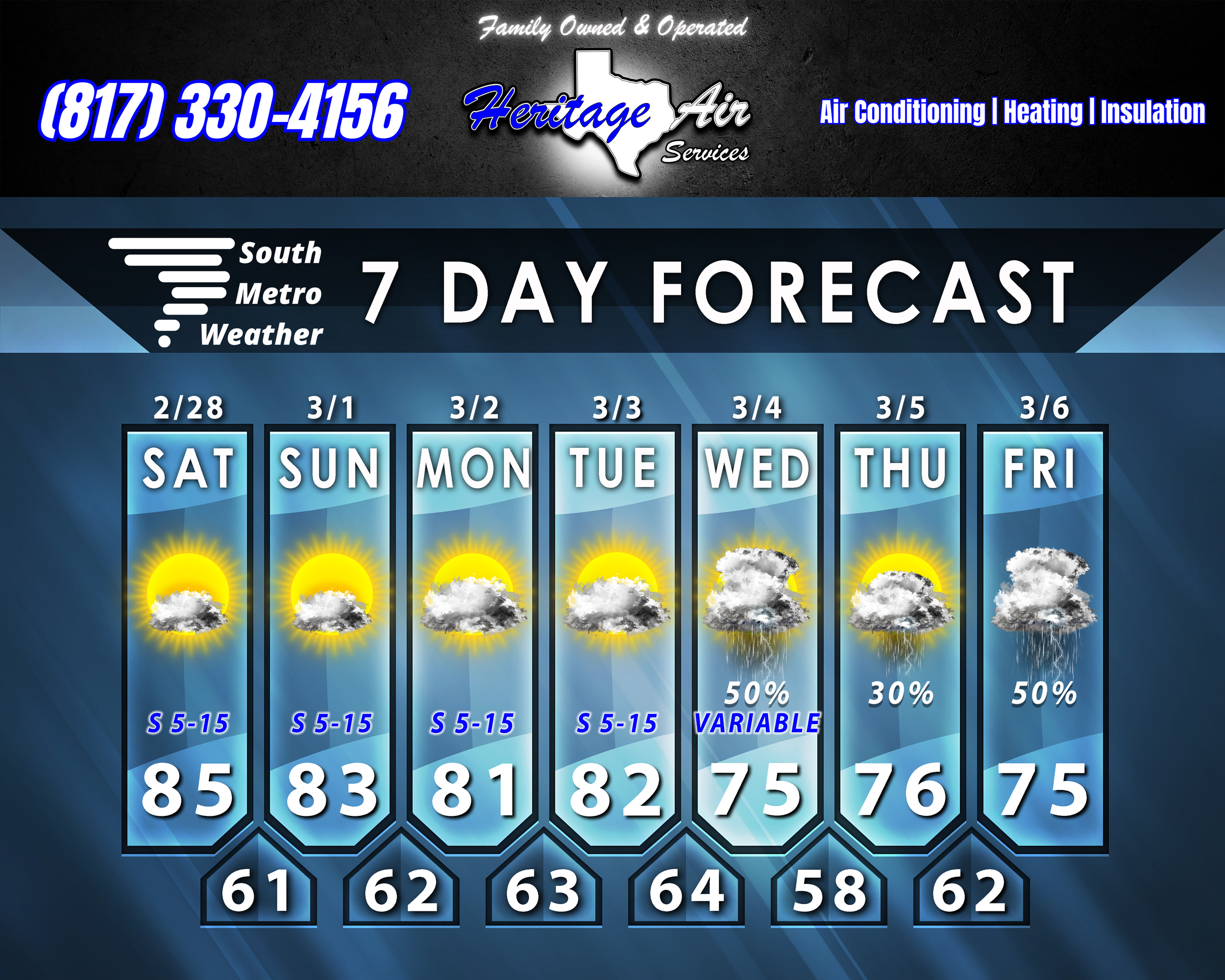
Today will be warm and breezy with highs in the mid 80’s and south winds of 5-15 MPH. Tomorrow we’ll probably see a few more clouds with more breezy south winds and highs in the low-mid 80’s. Monday and Tuesday looks more cloudy, but dry as rain stays north. Highs will stay in the low 80’s.
Wednesday we’ll enter a period of more active weather as a weak front dips down and stalls out. This setup will bring scattered showers and thunderstorms to our area, and some strong/severe storms will be possible. It’s still too far out to know too many specifics (timing, how likely each mode of severe weather will be, etc), but that should be more clear in the coming days. That stationary front rebounds north on Thursday, and a few storms will be possible that day - but it will be a lower chance overall.
I’m watching another opportunity for showers/storms headed our way Friday/Saturday, and this looks like it will bring more widespread activity as it is a stronger system. Severe weather potential and timing are unclear here, but higher coverage of heavy rain appears to be a better bet than Wednesday’s event.